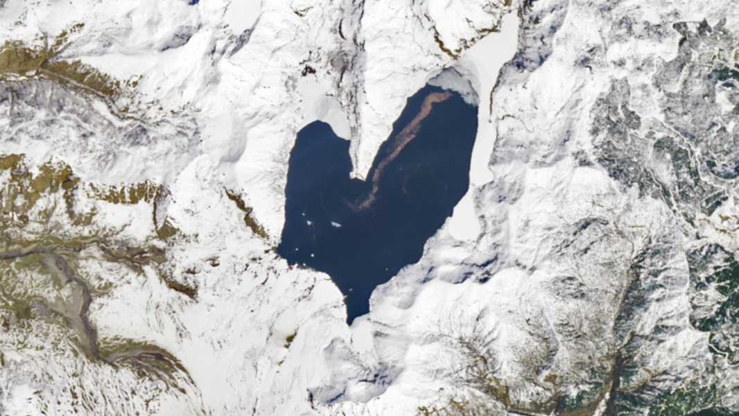

Spirit Lake is located about 3 miles (5 kilometers) north of the peak of Mount St. Helens and was altered by a record-breaking landslide during the volcano's 1980 eruption. (Photo credit: NASA/Landsat/Wanmei Liang)
This stunning satellite image shows the unique shape of Spirit Lake, which became a giant, anatomically abnormal heart after Mount St. Helens erupted in 1980. The resilient body of water is now under scrutiny by scientists who are studying how ecosystems recover from major natural disasters.
At about 8:32 a.m. PT (11:32 a.m. ET) on May 18, 1980, a magnitude 5.1 earthquake caused a “catastrophic eruption” of Mount St. Helens, an active stratovolcano located about 90 miles (150 kilometers) south of Seattle, Washington, according to the U.S. Geological Survey. Initially, the summit and north flank of the mountain collapsed, creating the largest subaerial (aerial) landslide in recorded history. The powerful explosion then sent a huge pyroclastic cloud skyward and rained rocks, lava, and ash onto the surrounding area.
The initial landslide and fallout killed fifty-seven people, making it the deadliest volcanic eruption in U.S. history. The disaster caused about $1 billion in damage (equivalent to about $3.8 billion today).
According to NASA's Earth Observatory, before the eruption, Spirit Lake “was a smaller lake consisting of western and eastern arms connected by a narrow channel of water shaped like the upper half of a heart.”
However, the landslide and subsequent explosion changed the lake's shape, making it wider and shallower — and completing its heart shape. The lake's surface area, now about 4.5 square miles (11.5 square kilometers), also rose about 200 feet (60 meters) above its previous level.
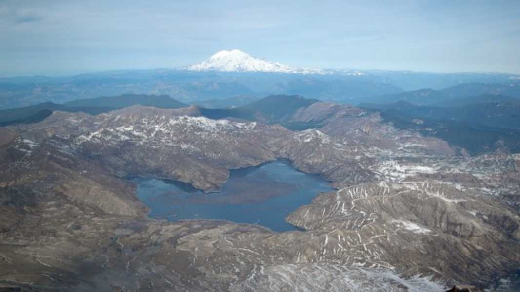
Trees uprooted during the eruption formed a permanent log raft on the surface of Spirit Lake. (The mountain in the background of this 2005 photo is Mount Rainer, not Mount St. Helens.)
Spirit Lake was once a popular tourist destination, with six different campsites and numerous log cabins (the remains of which are likely now beneath the lake's waters) located along its shores.
However, despite recovery from the eruption, the lake remains largely closed.
Sourse: www.livescience.com