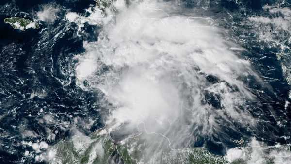

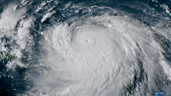
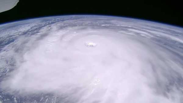
The prediction is that Tropical Storm Melissa will intensify into a hurricane in the approaching days.(Image credit: NOAA Satellites)
A Hurricane Watch is currently in effect for Haiti’s southern shore, along with a Tropical Storm Watch for Jamaica, as the recently established Tropical Storm Melissa steadily advances westward across the central part of the Caribbean. Melissa is accumulating energy from the almost-record-level warm Caribbean waters, which have remained untouched by any hurricane or tropical storm thus far this year. As of 2 p.m. EDT on Tuesday, it was positioned in the central Caribbean, roughly 305 miles (490 kilometers) to the south of Port-au-Prince, Haiti. The maximum sustained winds of Melissa were already registering at 50 mph (85 km/hr), and the National Hurricane Center projects that the storm will attain hurricane status by Saturday. Melissa’s movement was slightly north of due west, progressing at approximately 14 mph (22 km/hr).
Among the various possibilities for Melissa’s trajectory in the coming days, there’s the potential for several days of heavy rainfall over some of the Caribbean’s regions most prone to flooding. The likelihood of severe flooding and mudslides is growing for Haiti, as well as the southern areas of the Dominican Republic. Due to significant wind shear resulting from the position of the subtropical jet stream stretching from Florida eastward through the Bahamas, Melissa is not anticipated to present any danger to the continental United States for at least the next week. Ensemble models suggest only a slim possibility that the storm might veer far enough northwest to have an impact on Florida.
Melissa marks the 13th named storm of the 2025 Atlantic season, emerging just four days ahead of the average date for the season’s 13th named storm — October 25 (based on data from 1991-2020).
You may like
-

Forecasters caution that Hurricane Erin could generate 100-foot waves along the East Coast this week
-

A rare hurricane ‘dance’ known as the Fujiwhara effect could shield the East Coast from the worst effects of Tropical Storm Imelda
-
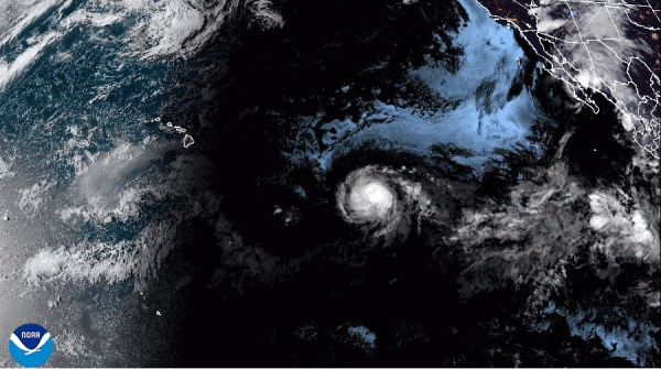
Hurricane Kiko, currently a Category 4 storm, is progressing towards Hawaii; however, forecasters predict it will weaken before reaching the islands
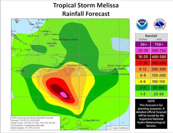
According to the anticipated path of Hurricane Melissa as of 11 am. EDT on Tuesday, October 21, cumulative rainfall through Friday could reach between 8 and 12 inches (200-300 millimeters) along certain areas of Hispaniola’s southern coastline, with more widespread accumulations of 4-6 inches (100-150 mm). These amounts and locations could significantly shift based on the storm’s evolution, and intense rainfall is likely to persist well beyond Friday in select areas. Near-record-level warm Caribbean waters are set to support Melissa’s intensification
Even though we are approaching the close of the Atlantic hurricane season, the Caribbean remains the most probable zone for a named storm to materialize during mid-to-late October. This is because wind shear further north typically intensifies to a point where it’s too powerful for tropical cyclones. At this specific juncture of the year, the waters in the Caribbean generally haven’t cooled substantially from their seasonal peak, while the wind shear, frequently a “graveyard” for budding tropical systems in the Caribbean, has typically diminished.
This week, Melissa is poised to cross some of the warmest waters ever documented this late in the season throughout the Atlantic basin. On average, sea surface temperatures across the Caribbean were at least 0.5 degrees Celsius (0.9°F) hotter as of Sunday, October 19, compared to any other year on that same date, excluding 2023 and 2024, as per analysis by Kim Wood of the University of Arizona.
Climate change driven by human activities has elevated the likelihood of the present warmth in the central Caribbean by a substantial factor of 500 to 800 times, according to Climate Central’s Climate Shift Index (refer to Fig. 2).
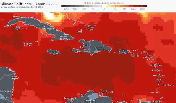
The oceanic version of the Climate Shift Index, displayed here for Monday, October 20, 2025, indicates the degree to which climate change, driven by human activity, has increased the probability of unusually elevated sea surface temperatures. What direction will Melissa take?
Should Melissa adhere to the initial forecast issued by the National Hurricane Center at 11 a.m. EDT on Tuesday, it would decelerate significantly just south of Haiti leading into the weekend (and potentially beyond), all while continuing to strengthen — a scenario that could spell devastating floods and mudslides over southern Hispaniola. Haiti’s vulnerability to the kind of disaster Melissa could unleash is exacerbated by poverty, governmental instability, and deforestation.
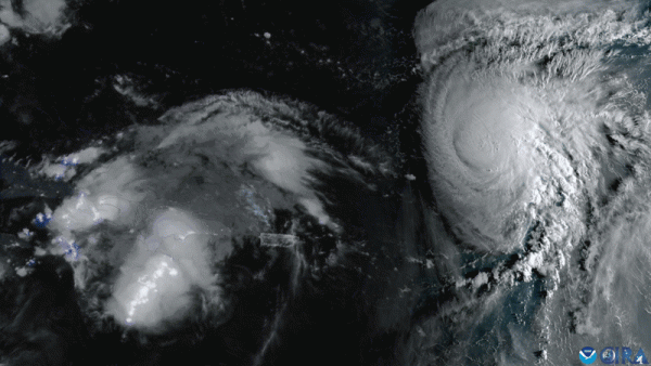
However, it’s important to note that forecast models have displayed a considerable lack of consensus concerning Melissa’s future (refer to Fig. 3 below). A contributing factor is the storm’s absence of a clearly defined center until Tuesday. With Melissa now officially recognized as a tropical storm, there may be an increase in agreement among the models. Nevertheless, steering currents appear to be weak, and sluggish storms can present challenges for even the most advanced forecast models.
Through early Tuesday, the European model maintained its preference for a gradual westward path, with the majority of its ensemble members projecting the system to remain in the Caribbean until at least the following Monday, October 27 (left side of Fig. 3), even though a notable minority anticipates Melissa moving toward western Haiti. The GFS (American) model (right side of Fig. 3) has been equally steadfast in its prediction that Melissa will execute a northward turn and depart the Caribbean, yet its ensemble members diverge sharply regarding the timing and placement of that turn. The Google DeepMind AI-driven model, recognized for its strong performance in track forecasting this year, also leans towards an eventual northward turn but again, with significant variations among ensemble members regarding its timing and location.
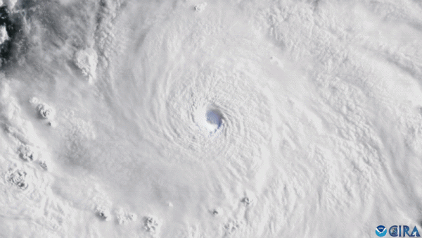
Intensity projection for Melissa
Consistent intensification seems a reasonable expectation for Melissa over the approaching days. The storm is situated in an exceptionally moist atmospheric environment: mid-level relative humidity is set to climb from 70-75 percent on Tuesday to potentially 80 percent by Wednesday. Wind shear was at a moderate level of 10-20 knots on Tuesday afternoon and is expected to persist at moderate to high levels for the next couple of days. Elevated pressure in the upper atmosphere is expected to develop over the Caribbean towards the weekend, which would promote intensification.
You may like
-
Forecasters caution that Hurricane Erin could generate 100-foot waves along the East Coast this week
-

A rare hurricane ‘dance’ known as the Fujiwhara effect could shield the East Coast from the worst effects of Tropical Storm Imelda
-

Hurricane Kiko, currently a Category 4 storm, is progressing towards Hawaii; however, forecasters predict it will weaken before reaching the islands
Coupled with the unusually warm surface waters, the Caribbean is currently experiencing substantial oceanic heat extending to a considerable depth, rendering it improbable that even a slow-moving Melissa will be significantly impeded by the churning of cooler subsurface waters. Although the NHC isn’t projecting rapid intensification for Melissa over the next five days, the 18Z Tuesday SHIPS model forecast indicated a 12% probability of rapid intensification of 35 mph within 24 hours, and a 25% probability of rapid intensification reaching 75 mph within 72 hours. This could potentially elevate Melissa to a category 3 strength by Friday afternoon, characterized by winds of 125 mph.
If the forecast scenario of an “M” storm in October cruising into the Caribbean, stalling, and turning north as a major hurricane seems familiar to you, it should: this outcome would be remarkably similar to what we saw with Matthew in 2016.bmcnoldy.blogspot.com/2025/10/meli…#Melissa
— @bmcnoldy.bsky.social (@bmcnoldy.bsky.social.bsky.social) 2025-10-23T12:03:13.447ZThe risks posed by late-season hurricanes in the Caribbean
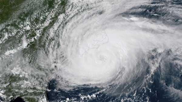
Slow-moving, late-season systems that gain strength in the Caribbean have the potential to cause immense devastation. In early October 2016, Hurricane Matthew advanced north over the far western regions of Haiti as a Category 4 hurricane. The storm deposited more than 20 inches (500 mm) of rainfall across much of eastern Cuba and southwestern Haiti, while also battering the Bahamas and several other islands. Matthew was responsible for 731 deaths and caused damages exceeding $16 billion (in 2016 USD).
RELATED STORIES
—Extreme weather caused damages exceeding $100 billion by June — breaking US records
—Understanding the reasons storm surge during hurricanes can be so disastrous
—How strong can hurricanes potentially become?
A little over 20 years prior, Hurricane Wilma experienced an astonishingly rapid intensification into a Category 5 behemoth in the northwest Caribbean. During October 18-19, 2005, Wilma established two unprecedented records for the Atlantic basin regarding rapid intensification. The storm deepened from 975 to 892 millibars (hPa) within 12 hours and from 979 to 882 mb within 24 hours — the latter accomplishment making Wilma the hurricane with the lowest central pressure in Atlantic history. Wilma also set a record for the greatest 24-hour increase in maximum sustained winds, escalating from 75 to 175 mph. Wilma made landfall on Mexico’s Yucatan Peninsula as a robust Cat 4 storm and rapidly progressed northeast to impact southwest Florida on October 24 at Cat 3 strength. Wilma resulted in 52 fatalities and inflicted $26.5 billion in damages (in 2005 USD).
Towards the end of October 1998, former Category 5 Hurricane Mitch delivered enormous amounts of rainfall over Guatemala, Nicaragua, and Honduras (ranging from 30 to 40 inches, or 750-1000 millimeters, across many areas), even as it decelerated and weakened, making landfall at Cat 1 strength. The ensuing floods and landslides caused approximately $6 billion in damages (in 1998 USD) and led to more than 11,000 confirmed deaths, alongside an additional 11,000 individuals reported as missing. Mitch holds the grim distinction of being the deadliest Atlantic hurricane of the satellite-monitoring era (i.e., since the 1960s), and potentially since the Great Hurricane of 1780.
This article was originally published by Yale Climate Connections.

Bob HensonJournalist and meteorologist
Bob Henson is a meteorologist and journalist situated in Boulder, Colorado. He has contributed articles on weather and climate for entities such as the National Center for Atmospheric Research, Weather Underground, and various other media outlets. Henson is the author of “The Thinking Person’s Guide to Climate Change” and several other books on meteorology. He also co-managed Weather Underground’s Category 6 news site until 2020. He possesses degrees from Rice University and the University of Oklahoma.
You must confirm your public display name before commenting
Please logout and then login again, you will then be prompted to enter your display name.
LogoutRead more

Hurricane Erin could unleash 100-foot waves across the East Coast this week, forecasters warn
A rare hurricane ‘dance’ known as the Fujiwhara effect could shield the East Coast from the worst effects of Tropical Storm Imelda

Hurricane Kiko, currently a Category 4 storm, is progressing towards Hawaii; however, forecasters predict it will weaken before reaching the islands
Watch Hurricane Erin reach Category 5 strength in a blaze of lightning
‘Now is the time’: Hurricane category 6 could be introduced under new storm severity scale
‘A serious threat’: China braces as Super Typhoon Ragasa, this year’s strongest storm, nears with winds of up to 177 mph
Latest in HurricanesSourse: www.livescience.com