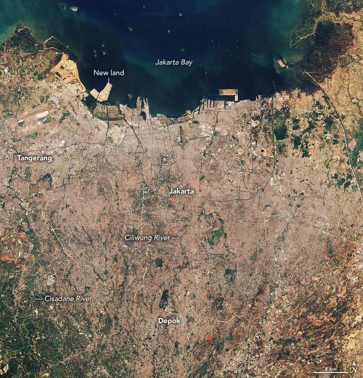
Jakarta is one of the fastest growing cities on Earth. While in 1930 it was home to half a million people, by 2020 this figure had increased 20-fold, exceeding 10 million people. When agglomeration is taken into account, the population of Indonesia’s capital is 35 million. It is second only to the Greater Tokyo.
The images presented show the growth of Jakarta. They were taken by NASA satellites 29 years apart, in July 1990 and September 2019. As is easy to see, during this time, the area of urban development has increased significantly. Also, the territory of the Indonesian capital has been enriched by man-made islands and land plots reclaimed from the sea over the years.
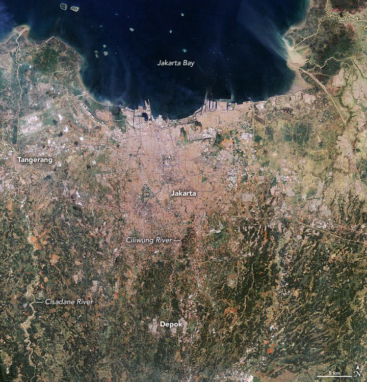

One of the main problems of Jakarta is that the city now literally began to go under water. The reason for this is the massive pumping of groundwater by residents who are deprived of other sources of fresh water. The rapidly growing population is emptying groundwater horizons, which is causing the soil to subside. Moreover, Jakarta is located on swampy soils in a river delta divided into many branches, which also leads to additional subsidence of the soil under the weight of modern development.
At the moment about 40 percent of Jakarta is below sea level. Because of this, the city increasingly suffers from flooding. According to some estimates, by 2050 already 95% of the city territory will lie below sea level. This factor, the general overcrowding of Jakarta, as well as the deteriorating environmental situation led to the fact that in 2019, the Indonesian government announced its intention to move the capital to the island of Kalimantan, where a new city will be built. This goal was originally planned to be achieved by 2024, but due to the effects of the COVID-19 pandemic, the project had to be suspended.