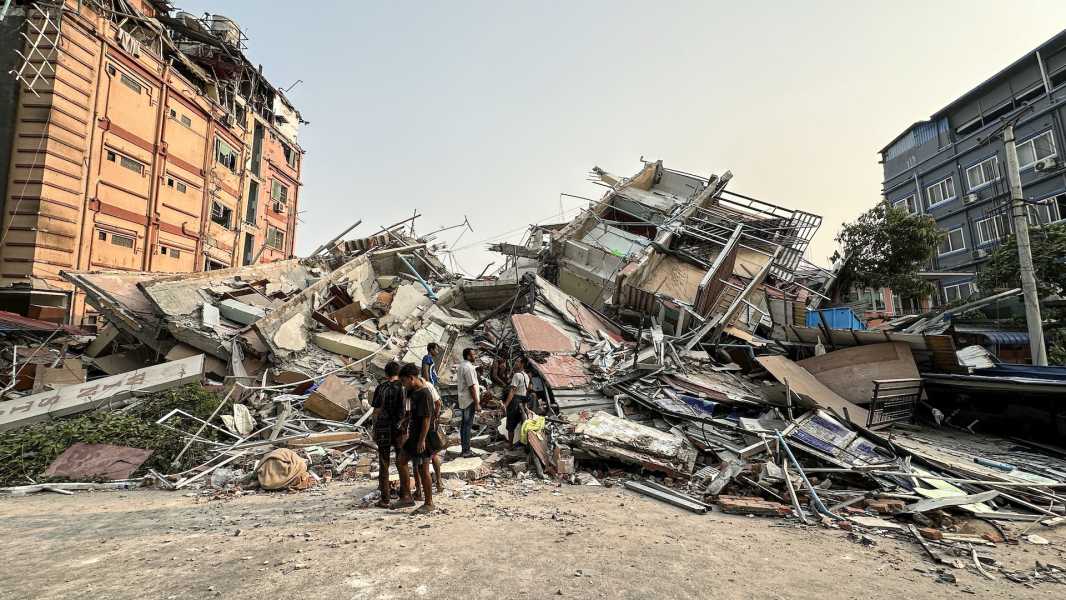

People stand near a collapsed building in Mandalay on March 28, 2025, after a devastating 7.7-magnitude earthquake struck. (Photo Credit: STR via Getty Images)
A strong magnitude 7.7 earthquake struck central Myanmar (formerly known as Burma) on Friday (March 28), causing strong shaking in Mandalay, the country's second-largest city, and also affecting neighboring countries such as China and Thailand, according to the U.S. Geological Survey (USGS).
The quake's epicenter was at a depth of about 6.2 miles (10 kilometers) and struck at 12:50 p.m. local time (2:20 a.m. ET), the U.S. Geological Survey said. Just 12 minutes later, a magnitude 6.7 quake at the same depth struck just south of the first one, and nine smaller quakes ranging in magnitude from 4.4 to 4.9 struck the region later in the day.
The quakes killed at least 144 people and injured 732, Myanmar's military junta said, according to The Washington Post. A monastery and several buildings also collapsed in the country. In Bangkok, at least 10 people were killed when a 33-story high-rise under construction collapsed; Thai authorities also said 16 were injured and 101 were missing, the Associated Press reported.
“Even though Bangkok was 'significantly further away from the fault zone' in Myanmar, it was a very powerful earthquake and it's not surprising that it was felt at such a distance,” Stanford University geophysics professor Gregory Beroza told Live Science.
The earthquakes occurred along the Sagaing Fault, which runs north-south and spans nearly 1,000 miles (1,600 km) across Myanmar toward the Andaman Sea. Earthquakes on this fault are called strike-slip faults, meaning one block of land slides horizontally past another block on the opposite side of the fault, according to the USGS. This is similar to the San Andreas Fault in California, which is also a strike-slip fault.
Myanmar, located south of the Himalayas, is a seismically active region and is known for its powerful earthquakes, Ben van der Pluijm, a professor emeritus of geology at the University of Michigan, told Live Science.
“This is because the continent of India sits on the Indian Plate. The Indian Plate has been moving north for about 100 million years,” van der Pluijm explained. “However, about 40 million years ago, India collided with the Eurasian Plate and continued to move north toward the Eurasian Plate.” This collision over millions of years helped create the Himalayas.
Sourse: www.livescience.com