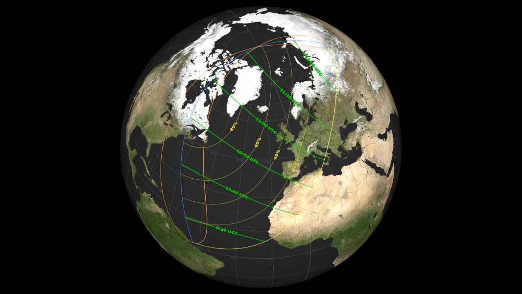

A NASA map showing where in the Northern Hemisphere the March 29, 2025, eclipse will be visible. (Image credit: NASA Scientific Visualization Studio)
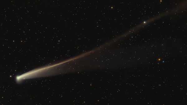
Tomorrow, millions of people will see their sun partially darkened as a partial solar eclipse covers part of our star.
The astronomical event will take place on Saturday, March 29, 2025, and will be visible from 13 U.S. states, as well as parts of northeastern Canada, much of Western Europe, and Africa. To help you determine if your location is in the path of the eclipse, NASA has released a map showing exactly what part of the Sun will be eclipsed, as well as the time it will begin in each region.
According to NASA, the partial eclipse will cover a significant portion of the sun on the east coast of the U.S. and Canada, with 83% of the solar disk obscured in St. John's, 64% in Portland, Maine, 43% in Boston, and 22% in New York City. In these locations, the partially eclipsed sun will rise, and the moon will create the illusion that our star has a pair of “devil's horns” in the morning light.
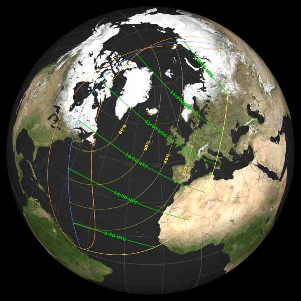
Full size version of the map.
On the NASA map, the yellow lines indicate how much of the Sun will be obscured from view at each location, while the green lines show the time in Coordinated Universal Time when the eclipse will reach its maximum.
For example, in St. John's, Canada, the partial eclipse will begin at 6:57 a.m. local time, peak at 7:52 a.m., and end at 8:51 a.m. In Boston, it will begin at 6:31 a.m. local time, peak at 6:38 a.m., and end at 7:07 a.m., and in New York City, it will begin at 6:44 a.m., peak at 6:46 a.m., and end at 7:04 a.m. In these locations, the Moon will already be partially covering the Sun when both bodies rise above the horizon in the morning.
Meanwhile in London, where the eclipse will cover a maximum of 31% of the Sun, it will begin at 10:07 local time, peak at 11:03 and end at 12:00.
The orange loops on NASA's map indicate areas where the eclipse will begin or end at sunrise and sunset: the left side of the western loop (over America) will see the eclipse end at sunrise, while the right side of that loop will see the eclipse begin at sunrise. Meanwhile, the blue line dividing these loops shows where the eclipse will peak at sunrise or sunset.
Sourse: www.livescience.com