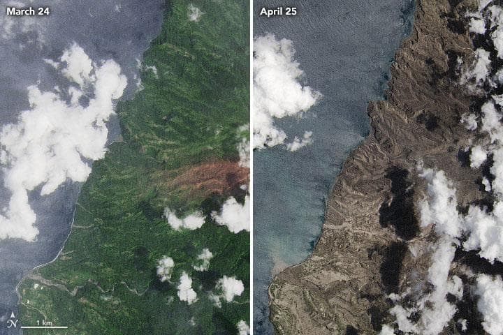
A volcano on the Caribbean island of St. Vincent erupted in April of this year. Even though the winds blew much of the eruption away from the island, it still rained tiny pieces of crushed rock and shards of volcanic glass.
St. Vincent Island before and after the eruption
Images captured by the Landsat 8 satellite allow you to assess the impact of the disaster. Already on the March image you can see an area of brown. This is a kind of harbinger of an imminent eruption – the “scar”, left in the vegetation cover of the island by volcanic gases.

The second picture was taken in April two weeks after the eruption. As is easy to see, there is no vegetation left at all in the northwestern part of the island. The eruption also destroyed many buildings and damaged infrastructure.
Much of the damage is caused by volcanic ash, the particles of which, unlike normal ash, are hard and have sharp edges. Such ash poses a great danger to humans and animals when inhaled, as well as to airliner engines. It can accumulate in thick layers, leading to the death of crops and the collapse of building roofs. And when saturated with water, ash can come down the slopes as a dense mass of mud that can cause catastrophic destruction in its path.
